 DOMUS GLOBAL
Warsaw · District guide
Mokotów in Warsaw: neighbourhoods, transport and apartments
Mokotów is not a single housing market. The pre-war streets and buildings of Stary Mokotów, M1-connected estates, the mixed office-and-residential Służewiec, Stegny, Sadyba and riverside Siekierki differ in housing, transport and everyday logistics. Below we compare the district’s main areas from the perspective of someone choosing a home.
Author: Siergiej Pinchuk

Mokotów in 60 seconds
As of 31 December 2024
Pole Mokotowskie · Racławicka · Wierzbno · Wilanowska · Służew
Sielce 2024 · Wilanów 2024 · Stegny 2025
tenement buildings · villas · large-panel estates · new developments
Main parts of Mokotów
The Warsaw Escarpment is one of the features that makes Mokotów internally diverse. Stary Mokotów and Wierzbno lie on the upper terrace, Sielce extends down towards Czerniakowska, while the other parts of the district offer further distinct housing settings. Within one district, pre-war urban streets, M1-connected neighbourhoods, large estates, new developments and lower-density riverside areas sit side by side.
Mokotów and the main parts of the district
Loading map…
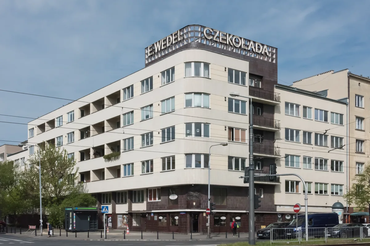
Stary Mokotów
Tenement buildings, modernism, low- and mid-rise housing, Puławska and Pole Mokotowskie.
Stary Mokotów contains a large share of the district’s pre-war and modernist housing. Around Puławska, Dąbrowskiego, Madalińskiego, Narbutta and Kazimierzowska you will find tenement buildings, villas, modernist apartment buildings and post-war infill. Access to M1 depends on the exact street: Racławicka and Pole Mokotowskie are important stations, while for addresses closer to the Warsaw Escarpment, it is particularly important to check whether the metro, tram or bus works best for the everyday journey. When buying, check the building condition, lift, parking, exposure and noise.
Check: building condition · lift · parking · walk to M1 or a tram · noise
Modernist architecture on Puławska Street in Stary Mokotów.
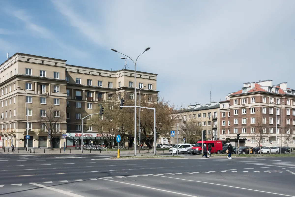
Sielce
The Warsaw Escarpment, Morskie Oko Park, mixed housing and the tram on Gagarina.
Sielce lies along the Warsaw Escarpment and extends down towards Czerniakowska. Housing ranges from older tenement buildings and houses to post-war blocks and new developments. Since May 2024, trams have run along Goworka, Spacerowa and Gagarina to the Sielce terminus, giving Lower Mokotów a new rail-based transport corridor. When choosing a home, consider the terrain and the climb towards the upper terrace, as well as the walk to the stop and traffic on the main roads.
Check: walk to the tram · changes in elevation · road traffic · character of nearby development
Sielce at Gagarina and Czerniakowska.
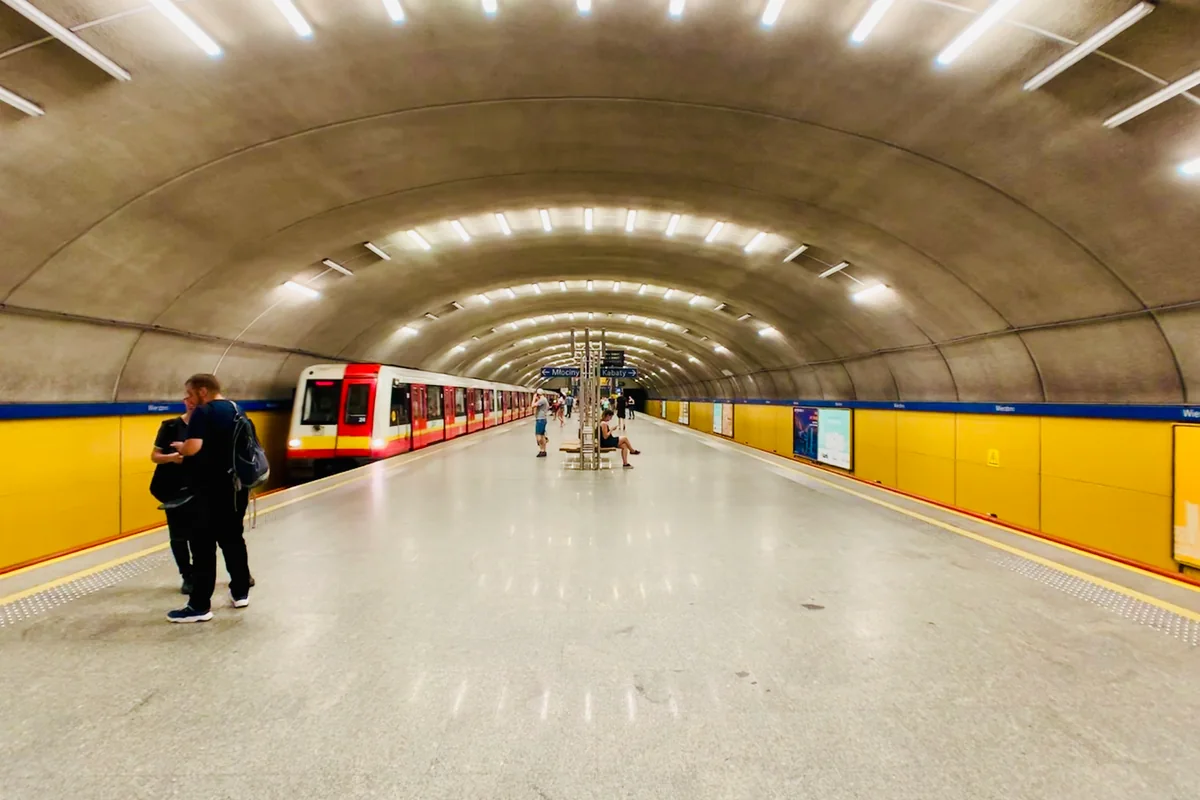
Wierzbno
M1, Puławska, Królikarnia and major differences from street to street.
Wierzbno combines direct M1 access with a very mixed housing stock: post-war estates, older buildings and new projects. The eastern side slopes towards Królikarnia and Arkadia Park, while the western side approaches Wołoska and Woronicza. When comparing listings, pay particular attention to exposure and traffic noise — proximity to the metro does not tell you what the immediate surroundings are like.
Check: distance to M1 · noise from main roads · exposure · immediate surroundings
M1 Wierzbno station — the main transport axis for this part of Mokotów.
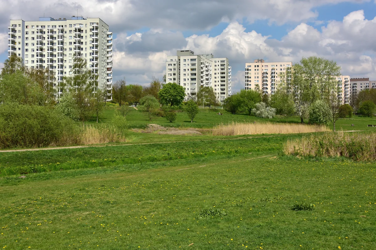
Służew
M1, Dolinka Służewska, large housing estates and substantial green space between buildings.
Służew has its own M1 station, Dolinka Służewska Park and a large stock of post-war housing estates, as well as lower-rise and newer buildings. In the property market, it is important to distinguish Służew from Służewiec — similar names do not mean a similar environment or the same everyday travel patterns.
Check: distance to M1 · construction technology · estate layout · parking · access to green space
Służew nad Dolinką and the green space surrounding the estate.
Służewiec
Offices, new residential development, trams and rail on the western edge.
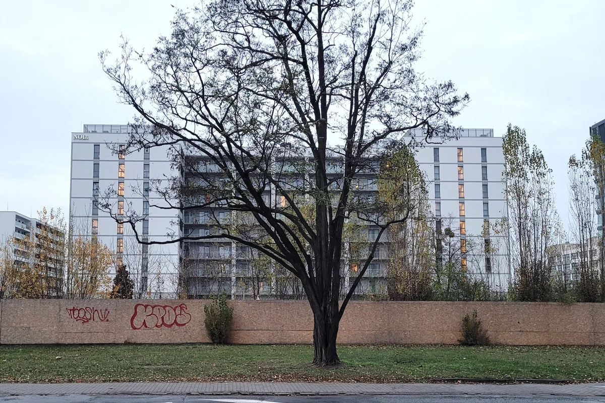
Służewiec remains a major office district, but residential and service uses are increasingly present alongside the offices. Around Cybernetyki, Postępu, Konstruktorska and Bokserska, new buildings operate in surroundings that are still changing rapidly. Transport relies on trams and buses, while the western part is served by Warszawa Służewiec railway stop. When assessing an apartment, check peak-hour traffic, nearby construction sites, the walk to rail and the quality of the pedestrian route.
Check: peak-hour traffic · active construction sites · walk to rail or tram · everyday services at street level
Contemporary development on Postępu Street in Służewiec.
Stegny
Large housing estates, newer development and tram service since 2025.
Stegny has a large share of post-war housing estates as well as newer developments. Since 28 June 2025, trams have run along św. Bonifacego to the Stegny terminus. This changed the transport model in a part of Mokotów that previously relied primarily on buses. When comparing addresses, still check the walking distance through the estate to the stop and access to al. Wilanowska and Sobieskiego.
Check: distance to the tram · estate layout · construction technology · walk to everyday services
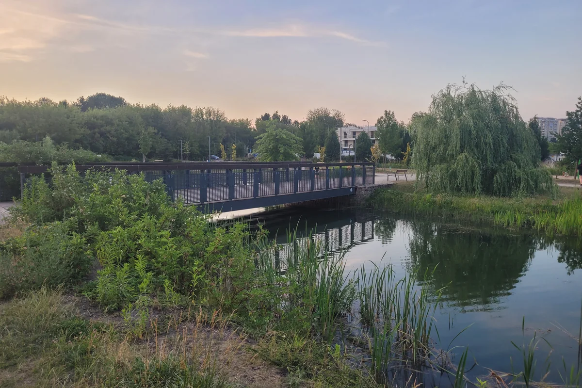
Park Enklawa in Stegny.
Sadyba
Houses, quieter streets, apartment buildings and Jeziorko Czerniakowskie in this part of Mokotów.
Sadyba is not a single type of housing market. It includes houses and villas, older apartment buildings and newer developments. Jeziorko Czerniakowskie and nearby green spaces matter for some addresses, but that advantage should not be applied to all of Sadyba. The new tram route along Sobieskiego has improved access to rail-based public transport, but the actual distance to the tracks still depends on the specific street.
Check: housing type · walk to the tram · immediate street · actual distance to green space
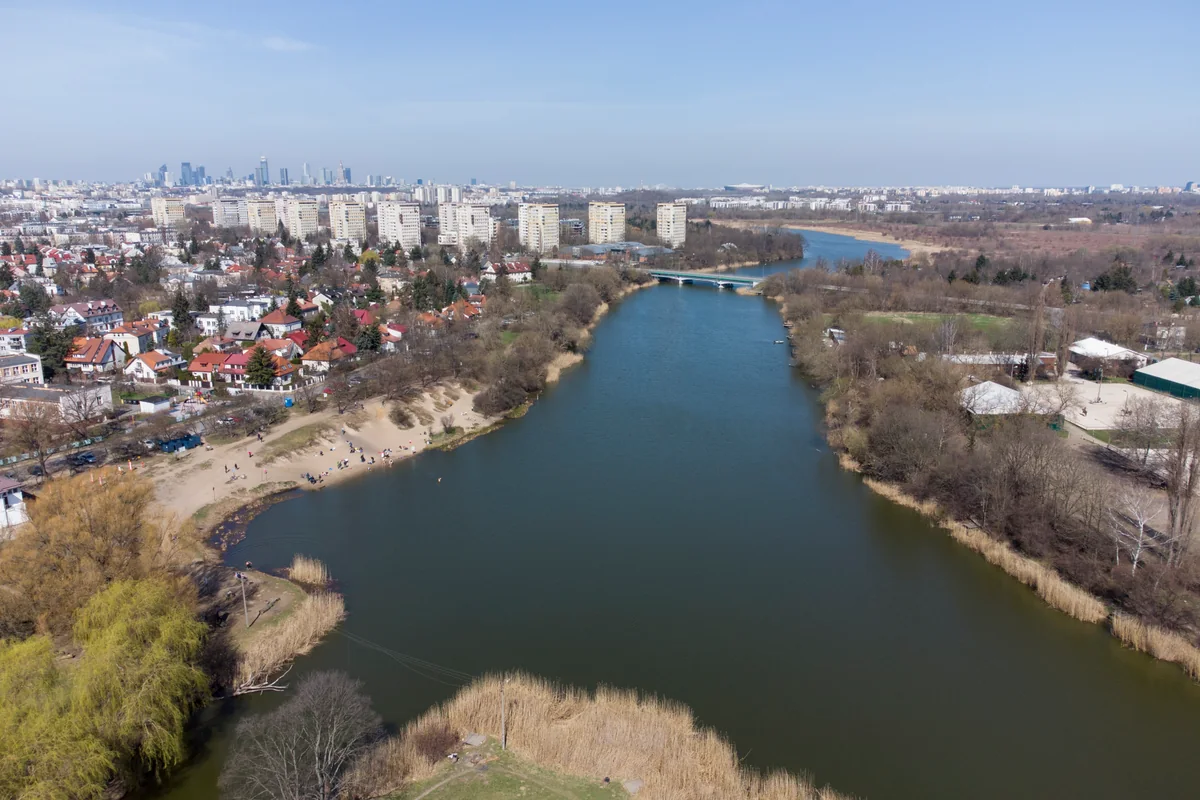
Jeziorko Czerniakowskie and development in its immediate surroundings.
Siekierki
Newer housing, lower density and riverside areas.
Siekierki is less compact than Stary Mokotów, Wierzbno or Stegny. New housing developments sit alongside lower-density areas, plots, gardens and the Vistula flood embankment. Without direct M1 access, buses, cycling and the road network play a greater role. Towards Augustówka the area becomes even less urban, so the full everyday journey is particularly important when choosing a home.
Check: bus access · road network · everyday services · future development around the property · access to riverside areas
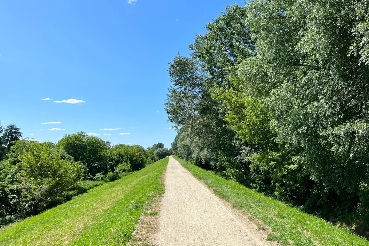
The Vistula embankment in Siekierki.
Comparing the main parts of Mokotów
| Area | Typical built environment | Transport | What to check in particular |
|---|---|---|---|
| Stary Mokotów | tenement buildings, modernism, villas, post-war infill | M1, trams, buses | building condition, parking and noise |
| Sielce | older housing, blocks, new developments | tram on Gagarina, buses | the escarpment, walk to transport and traffic |
| Wierzbno | post-war estates, older and new buildings | M1, trams, buses | main roads, exposure and the exact street |
| Służew | large estates, lower-rise housing, new buildings | M1, buses | distance to the station and estate character |
| Służewiec | offices, new housing and services | tram, Warszawa Służewiec rail, buses | traffic, construction and pedestrian access |
| Stegny | post-war estates and new developments | tram, buses | actual distance to the stop |
| Sadyba | houses, villas and apartment buildings | tram on Sobieskiego, buses | distance to transport and street character |
| Siekierki | new estates and dispersed lower-rise housing | buses, cycling, road network | full everyday logistics without M1 |
Transport: Mokotów has several different commuting systems
There is no single transport model in Mokotów. Areas on the upper terrace of the Warsaw Escarpment are better connected to M1, lower-lying parts of the district have gained new tram links, Służewiec combines trams with rail, while buses and the road network remain more important in Siekierki.
M1 as the main axis for part of Mokotów
M1 serves Mokotów through Pole Mokotowskie, Racławicka, Wierzbno, Wilanowska and Służew stations. For homes within a practical walking distance, access to the metro is one of the location’s key parameters. Sielce, Sadyba, parts of Stegny and Siekierki operate according to a different transport model.
The new tram network in lower-lying Mokotów
The tram network in this part of Warsaw has changed significantly in recent years: in May 2024 trams began running along Goworka, Spacerowa and Gagarina to Sielce; in October 2024 the main route towards Wilanów opened; and in June 2025 the branch to Stegny followed. Older descriptions of transport in Mokotów may therefore no longer reflect current conditions.
Rail on the western side of Służewiec
Warszawa Służewiec railway stop gives the western part of Służewiec an additional rail option independent of M1. This advantage should not be applied to the whole of Służewiec — for each address, check the actual walk to the platform.
Green space: from Pole Mokotowskie to Jeziorko Czerniakowskie
Pole Mokotowskie
The park covers 74.43 hectares and lies across Mokotów, Ochota and Śródmieście. For Mokotów, it is particularly relevant to Wyględów and the northern part of Stary Mokotów. It should not be described as a park belonging exclusively to Mokotów.
Morskie Oko and Arkadia
Morskie Oko Park is an important green space for Sielce and Stary Mokotów. Arkadia Park below Królikarnia plays a similar role around the boundary of Wierzbno and Sielce.
Dolinka Służewska
The park, with Potok Służewiecki, ponds and recreational areas, is one of the key green spaces in Służew.
Jeziorko Czerniakowskie
The nature reserve and recreational area are an important feature of south-eastern Mokotów. When assessing a property, check the actual distance to the reserve — the name Sadyba or Czerniaków does not guarantee proximity.
Housing market: several markets within one district
In Stary Mokotów, the practical value of an apartment often depends on the condition of the specific tenement or modernist building. In Służew and Stegny, compare construction technology, condition and estate layout. In Służewiec, the age of the development and the changing office-and-residential surroundings are important. Sadyba includes both houses and apartment buildings, while in Siekierki the immediate surroundings and access to services play a major role. A single average for all of Mokotów hides these differences.
What to compare in property listings
- year and construction technology
- condition of common areas, installations and the lift
- parking or garage
- actual walk to M1, a tram or rail
- noise from major roads
- exposure and distance to neighbouring buildings
- active construction sites and future surroundings
- everyday services within walking distance
How to narrow your search within Mokotów
M1 and older urban housing
Start with Stary Mokotów and Wierzbno if you want to combine metro access with a more urban street pattern and an older housing stock.
M1, large estates and green space
Look at Służew if direct M1 access matters but you are also considering large housing estates with more space between buildings.
Newer housing and western Mokotów
Look at Służewiec if you are considering newer buildings and regularly use western Warsaw, rail or the Wołoska corridor.
Lower-lying Mokotów and trams
Compare Sielce, Stegny and Sadyba if having the metro at your doorstep is not essential and the new tram network and the character of the individual estate matter more.
Lower density by the Vistula
Look at Siekierki if you are considering less compact housing and are comfortable with everyday logistics based primarily on buses, cycling and driving.
Compare Mokotów with other Warsaw districts
If Mokotów does not give you a clear answer, compare it with districts that offer a different mix of transport, housing age and urban form.
Ursynów
Worth comparing if M1, large housing estates and a more consistent southern-Warsaw layout are key priorities.
Compare UrsynówWilanów
Worth comparing if you are considering Stegny, Sadyba or the lower-lying parts of Mokotów but want a larger share of newer housing and are comfortable relying mainly on trams and buses.
Compare WilanówOchota
Worth comparing if Stary Mokotów interests you most: a central location, older housing and proximity to Pole Mokotowskie, but with a different transport pattern.
Compare OchotaFrequently asked questions about Mokotów
Which parts of Mokotów have good access to M1?
Stary Mokotów, Wierzbno, the area around al. Wilanowska and Służew are most closely linked to M1. Pole Mokotowskie, Racławicka, Wierzbno, Wilanowska and Służew stations serve the central and western axis of the district. For any specific property, however, check the actual walking distance.
Are Służew and Służewiec the same place?
No. They are different parts of Mokotów. Służew is strongly associated with M1 and Dolinka Służewska, while Służewiec is centred on the Wołoska–Domaniewska–Postępu corridor, offices, newer housing and Warszawa Służewiec railway stop.
Does Stegny have tram service?
Yes. Since 28 June 2025, trams have run along św. Bonifacego to the Stegny terminus.
Does Sadyba have a metro station?
There is no M1 station within Sadyba. Trams along the Sobieskiego corridor and buses are more important; reaching M1 requires an additional walk or ride depending on the exact address.
Where in Mokotów should I look for older housing?
Stary Mokotów and parts of Sielce have the strongest concentration of older housing, but the age, construction type and condition should always be checked for the specific building.
How should I assess an apartment in Służewiec?
Check not only the building, but also peak-hour travel, distance to a tram or Warszawa Służewiec railway stop, active construction sites and the quality of the walk to everyday services.
Where should I start when choosing an apartment in Mokotów?
Start with the exact address, building type and your everyday route. Only then narrow the search to specific parts of Mokotów.
Sources and updates
Data and infrastructure
- Mokotów District Office, City of Warsaw — Management Board activity report for 2024.
- Metro Warszawskie — current metro map.
- Tramwaj do Wilanowa — tram service on Gagarina.
- Tramwaje Warszawskie — 2024 Annual Report, operating data.
- Tramwaj do Wilanowa — tram service to Stegny.
- Zarząd Zieleni m.st. Warszawy — Pole Mokotowskie.
- Zarząd Zieleni m.st. Warszawy — Morskie Oko Park.
- Zarząd Zieleni m.st. Warszawy — Arkadia Park.
- Zarząd Zieleni m.st. Warszawy — Dolinka Służewska Park.
- Regional Directorate for Environmental Protection in Warsaw — Jeziorko Czerniakowskie.
Photos and graphic materials
- Królikarnia — Adrian Grycuk, Wikimedia Commons, CC BY-SA 3.0 PL; crop: DOMUS GLOBAL.
- Stary Mokotów, Wedel House — Adrian Grycuk, Wikimedia Commons, CC BY-SA 3.0 PL; crop: DOMUS GLOBAL.
- Sielce, Gagarina / Czerniakowska — Adrian Grycuk, Wikimedia Commons, CC BY-SA 3.0 PL; crop: DOMUS GLOBAL.
- Wierzbno, M1 station — Kgbo, Wikimedia Commons, CC BY-SA 4.0; crop: DOMUS GLOBAL.
- Służew nad Dolinką — Adrian Grycuk, Wikimedia Commons, CC BY-SA 3.0 PL; crop: DOMUS GLOBAL.
- Służewiec, Postępu 24 — Wistula, Wikimedia Commons, CC BY-SA 4.0; crop: DOMUS GLOBAL.
- Stegny, Park Enklawa — Wistula, Wikimedia Commons, CC BY-SA 4.0; crop: DOMUS GLOBAL.
- Jeziorko Czerniakowskie — Emptywords, Wikimedia Commons, CC BY-SA 4.0; crop: DOMUS GLOBAL.
- Siekierki, Vistula embankment — Daeheung, Wikimedia Commons, CC BY-SA 4.0; crop: DOMUS GLOBAL.


Looking for an apartment in Mokotów? Start with the address, the route and the building type.
Send us a link to the listing or describe where you travel most often, what type of housing you are considering and what you are not willing to compromise on. We can then compare the specific part of Mokotów, the building and your everyday logistics.